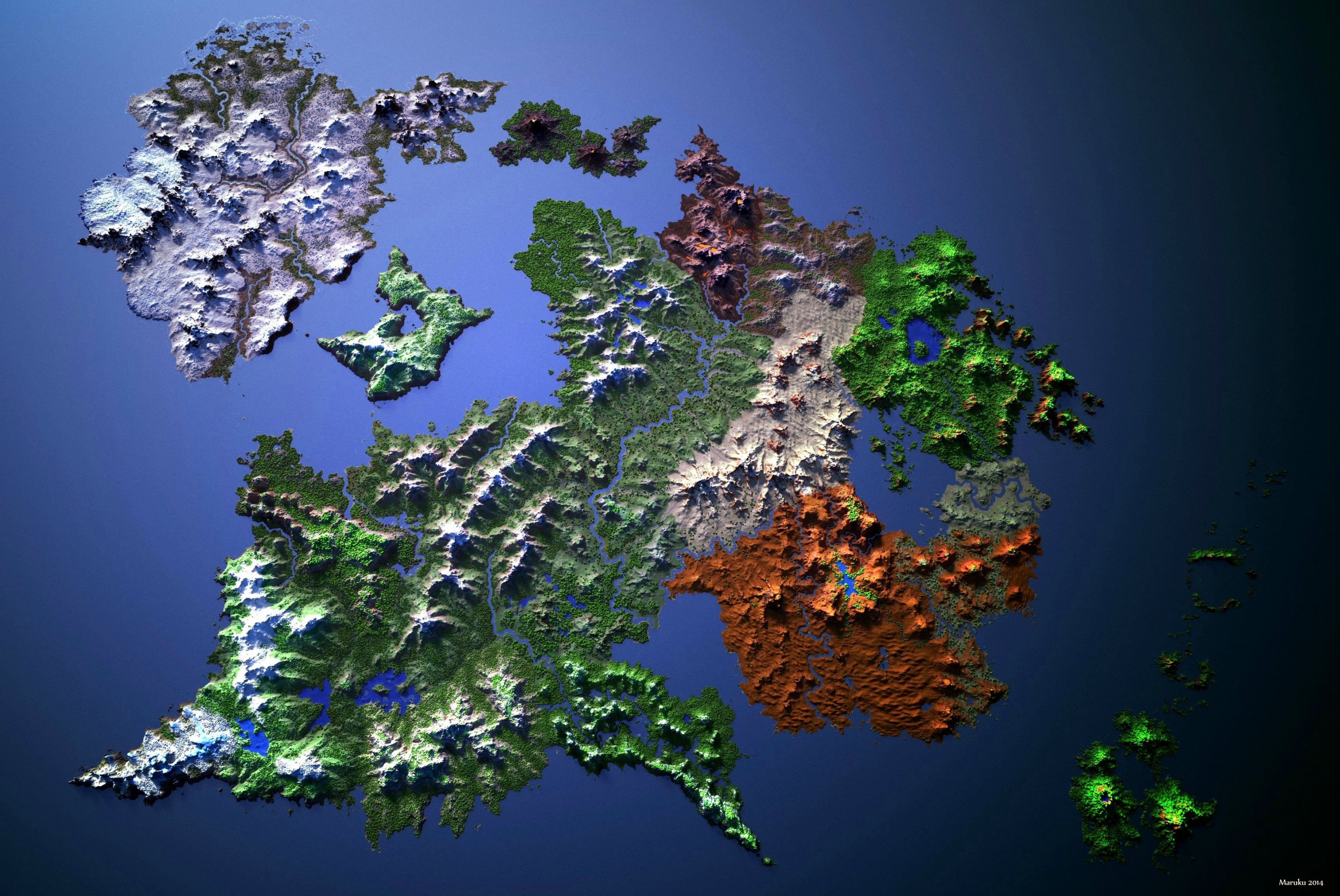
It is a method to convert an image into digital form and perform some operations on it, in order to get an enhanced image or to extract some useful information from it.
Usually Image Processing system includes treating images as two dimensional signals while applying already set signal processing methods to them.
Read More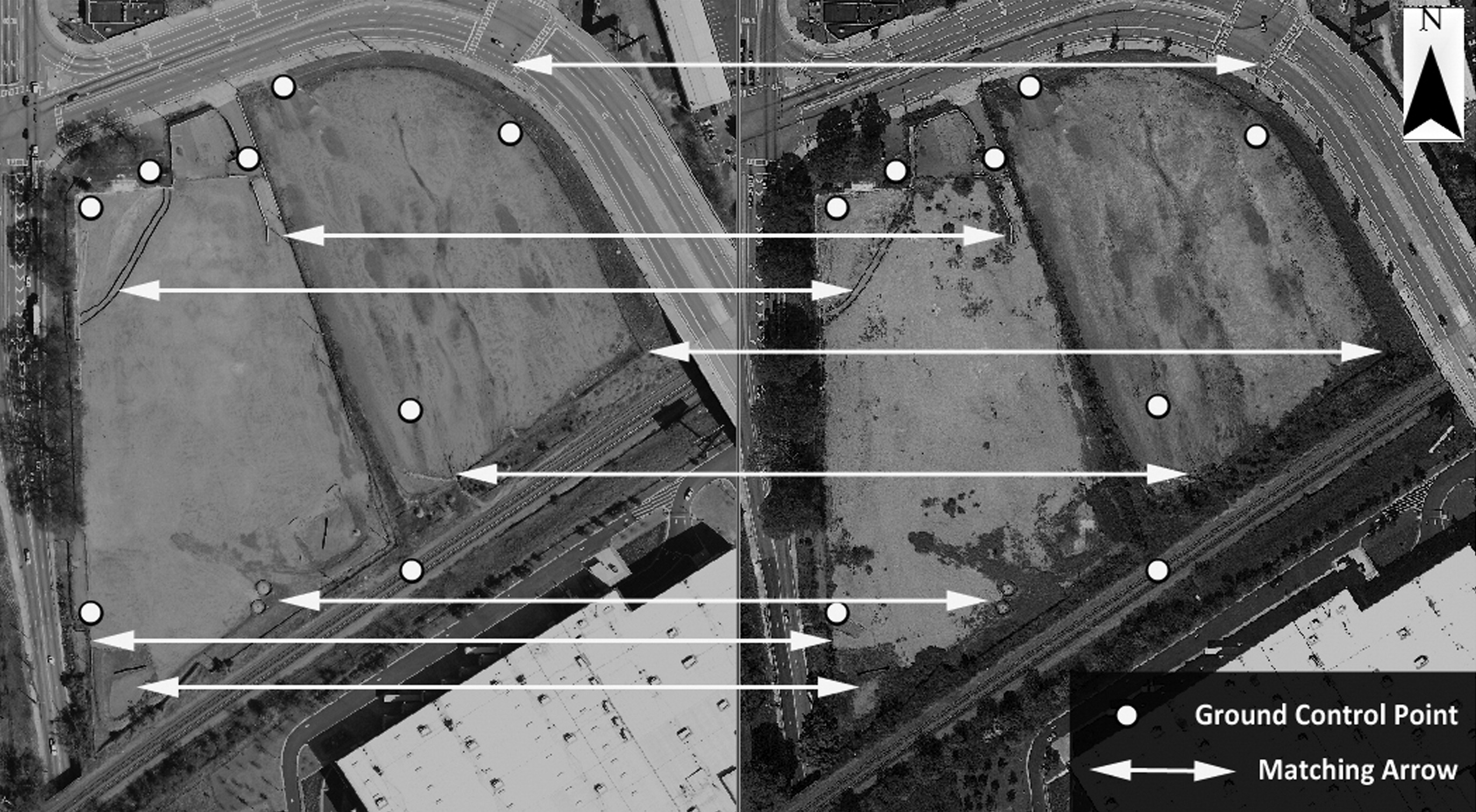
Basically what Georeferencing states that the internal coordinate system of a map or aerial photo image can be related to a ground system of geographic coordinates.
In other words, Georeferencing means to associate something with locations in physical space.
Read More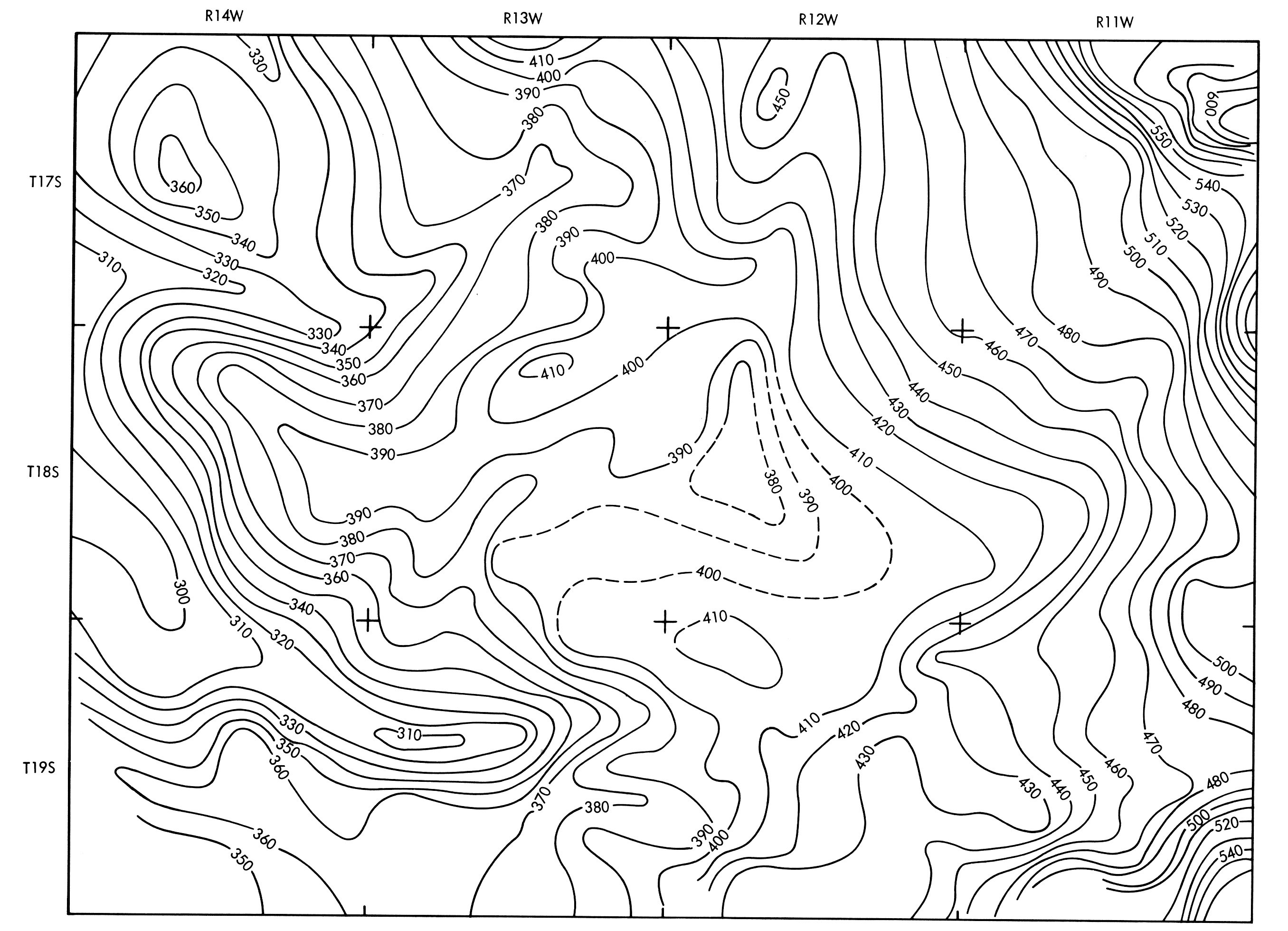
A line on a map that represents a constant value of the parameter being mapped. This line includes points of equal value and separates points of higher value from points of lower value.
The contour lines and contour intervals depict elevation / altitude and depth, illustrating the general terrain for an area.
Read More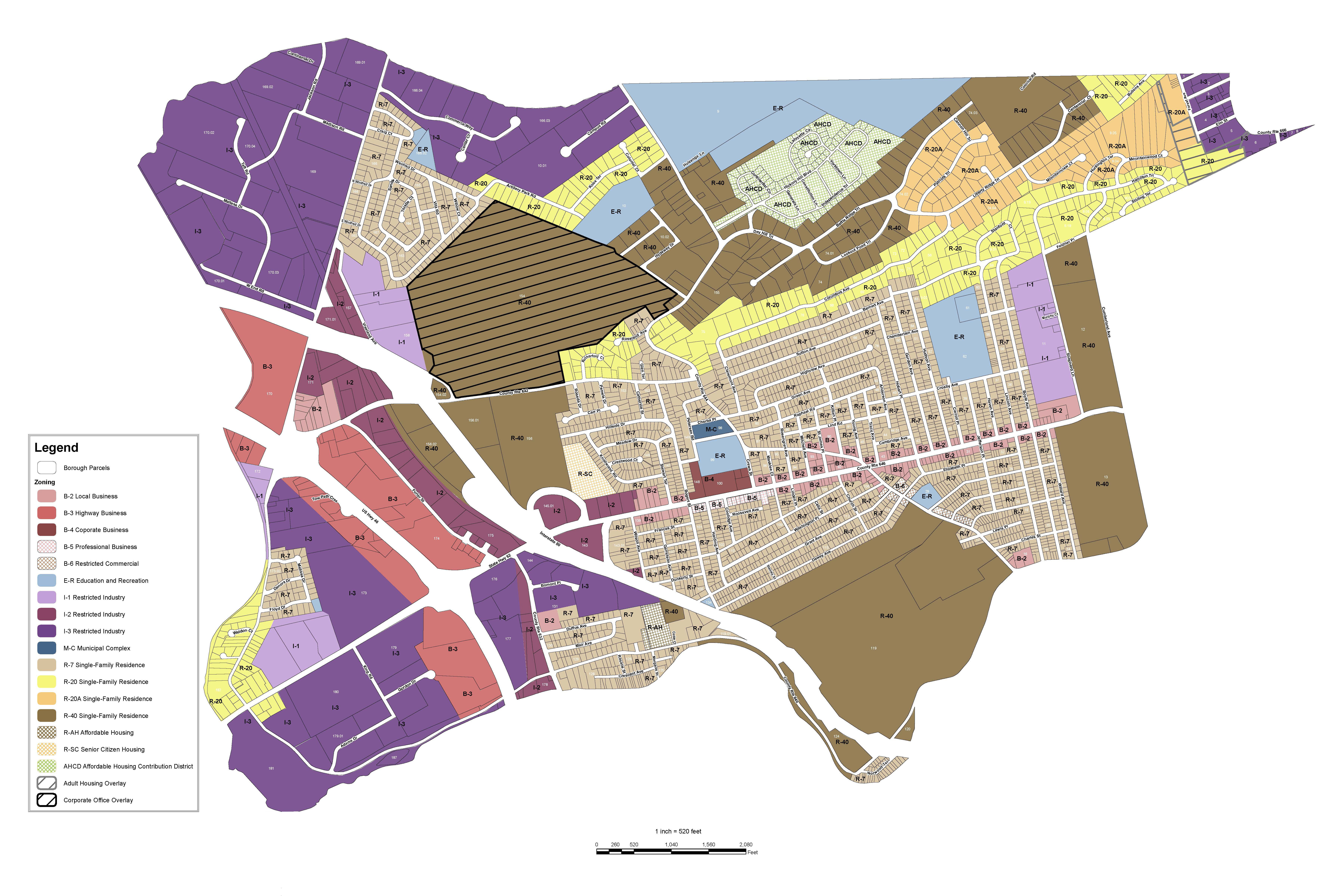
The basic drawings (maps) of the landcadastre (ownership boundaries) for all public and private lands. Parcel maps are typically maintained at a variety of scales,which show only diagram layouts of the basic landcadastre.
We use Ordnance Survey #Open Data and QGIS software to create the maps.s
Read MoreInfoTech Enterprises, Pankaj Plaza, Sector 10, Dwarka, New Delhi – 110075, INDIA
info@infotechcad.com
+91(989)-100-0445